

You're now following
Error following user.
This user does not allow users to follow them.
You are already following this user.
Your membership plan only allows 0 follows. Upgrade here.
Successfully unfollowed
Error unfollowing user.
You have successfully recommended
Error recommending user.
Something went wrong. Please refresh the page and try again.
Email successfully verified.

miri, malaysia
It's currently 6:10 AM here
Joined July 12, 2013
0 Recommendations
Lerry W.
@lerrywilliam
1.1
1.1
100%
100%
miri, malaysia
100%
Jobs Completed
100%
On Budget
100%
On Time
50%
Repeat Hire Rate
Remote Sensing Engineer, Geoinformation System, Web Mapping
Contact Lerry W. about your job
Log in to discuss any details over chat.
Portfolio
Portfolio
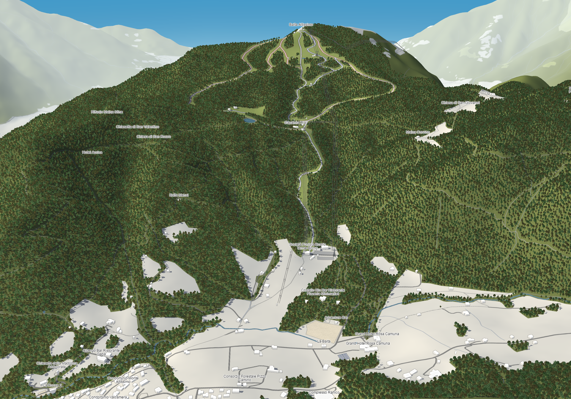

3D Map examples

Mapping project in Freelancer

Mapping project in Freelancer

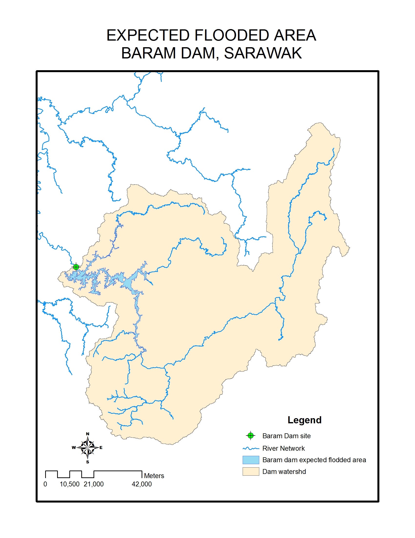
Augmented reality GIS
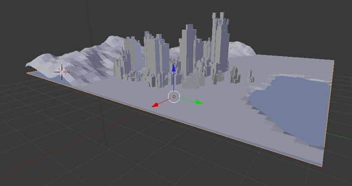

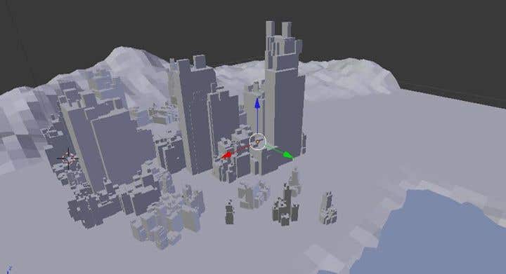
Graphic Design/geospatial 3d

Graphic Design/geospatial 3d
3D Map examples
Mapping project in Freelancer
Mapping project in Freelancer
Augmented reality GIS
Graphic Design/geospatial 3d
Graphic Design/geospatial 3d
Reviews
Changes saved
Showing 1 - 3 out of 3 reviews
$30.00 USD
Graphic Design
Cartography & Maps
GPS
Imaging
+1 more

•
$15.00 USD
Software Architecture
Geolocation
Geospatial
•
$20.00 USD
Cartography & Maps
J

•
Experience
GIS
Aug 2014 - Present
-GIS
-Web Mapping
-Remote Sensing
-Geology
-Mapping and Cartography
GIS Engineer
Jul 2013 - Aug 2014 (1 year, 1 month)
GIS
Remote Sensing
Web Mapping
Remote sensing analyst
Jun 2012 - Sep 2012 (3 months, 1 day)
Remote sensing analyst
Education
Remote Sensing
(4 years)
Qualifications
ArcGIS Desktop Associate 10.0
ESRI
2014
Esri Certified ArcGIS Desktop Associates are adept at applying basic GIS and ArcGIS concepts and processes to workflows and are skilled at using ArcGIS Desktop to visualize, manage, and analyze geospatial data.
This certification is targeted for ArcGIS 10.0 Desktop users with the equivalent of two or more years experience using ArcGIS.
Esri Technical Certification
ESRI
2013
The Esri Technical Certification Program recognizes qualified individuals who are proficient in best practices for using Esri software and creates a workforce highly skilled in applying Esri best practices to advance the goals of their organizations.
Contact Lerry W. about your job
Log in to discuss any details over chat.
Verifications
Certifications
Top Skills
Browse Similar Freelancers
Browse Similar Showcases
Invite sent successfully!
Thanks! We’ve emailed you a link to claim your free credit.
Something went wrong while sending your email. Please try again.
Copy to clipboard failed, please try again after adjusting your permissions.
Copied to clipboard.
Loading preview
Permission granted for Geolocation.
Your login session has expired and you have been logged out. Please log in again.